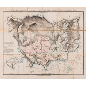
Norfolk Island Map, 1840
You must be a subscriber, and be logged in to view price and dealer details.
Subscribe Now to view actual auction price for this item
When you subscribe, you have the option of setting the currency in which to display prices to $Au, $US, $NZ or Stg.
This item has been included into following indexes:
Visually similar items

Red coral bead and onyx earrings, on 9ct gold hooks

A George III walnut chest of drawers, 80 cm high, 100 cm wide, 50 cm deep

A pair of ruby stud earrings, each comprising an oval cut ruby. Total ruby weight: 0.90cts total. 18 carat yellow gold rubbed over setting. Made by Kozminsky.

A Polish .800 silver compact, circa 1920-1940s, with marks for .800 from 1920-1963, with additional rubbed marks, the circular compact with a slightly cushion profile with an embossed garland of flowers to the top, opening to reveal a mirror inside the lid
