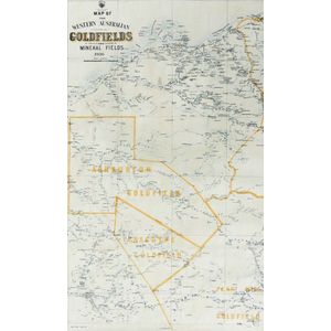
West Australian Goldfields and Mineral Fields Maps (1936-1937)
Two early 20th century West Australian goldfields and mineral fields maps, 1936 and 1937 showing localities of Ashburton, goldfields, Gascoyne, Peak hill, Pilbarra, Nullacine lithograph No.114, sheet No.5 and No.6 one dated 18.1.36, the other, 12.2.37. 96.5 x 59 cm
You must be a subscriber, and be logged in to view price and dealer details.
Subscribe Now to view actual auction price for this item
When you subscribe, you have the option of setting the currency in which to display prices to $Au, $US, $NZ or Stg.
This item has been sold, and the description, image and price are for reference purposes only.
This item has been included into following indexes:
- maps - general 463
