Pacific Ocean Discoveries 1700s
click the photo to enlarge
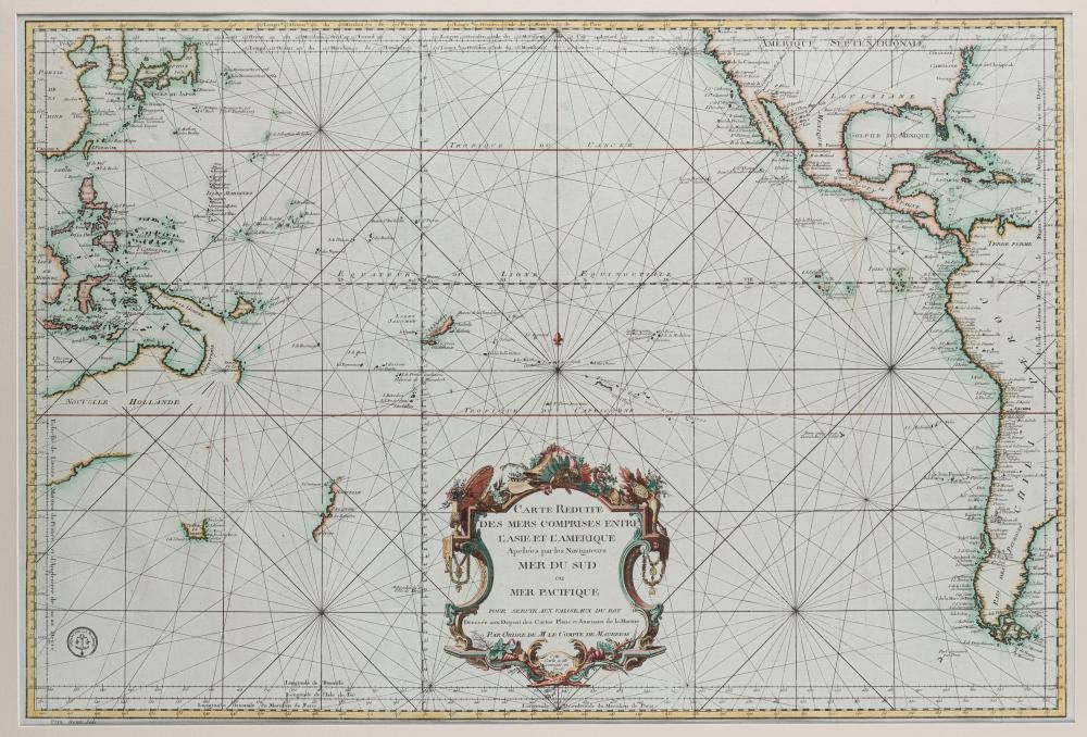
Bellin, Jacques Nicolas (1703-1772). 'Carte Reduite Des Mers Comprises Entre L'Asie et L'Amerique Apelees par les Navigateurs Mer Du Sud ouMer Pacifique...', [Paris: Depot de la Marine, 1776.], attractively hand-coloured, 55 x 82 cm (image), 83 x 112 cm (frame). Important chart showing the opening up of the Pacific Ocean and the discoveries of Australasia immediately prior to the great voyages of Bougainville and Cook. Originally issued in 1742, the map depicts a Pacific with California correctly shown as a peninsula, a fairly accurate Far East Asia, and a view of Australasia showing the discoveries of various Dutch explorers, including Janszoon and Tasman. However, the discoveries of the explorers Wallis, Bougainville and James Cook (whose voyages had been completed by this publication date) have yet to be added, so the depiction of the Australian continent is distorted, with imagined dotted coastlines joining Tasmania and New Guinea with the mainland. The west coast of New Zealand emerges unformed from a vast Pacific which is dotted with mostly imaginary islands.
You must be a subscriber, and be logged in to view price and dealer details.
Subscribe Now to view actual auction price for this item
When you subscribe, you have the option of setting the currency in which to display prices to $Au, $US, $NZ or Stg.
This item has been sold, and the description, image and price are for reference purposes only.
This item has been included into following indexes: