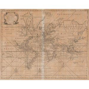
A very rare ottoman hand-coloured world map from the 'Cedid…
click the photo to enlarge
A very rare ottoman hand-coloured world map from the 'Cedid Atlas' (Atlas-i Cedid), the first published atlas in the Muslim world, printed and published in Istanbul, 1803. Based on late 18th century European world maps it details Cook's three voyages of exploration and maintains elements from those maps such as Australia being named New Holland (in Turkish script) and Stewart Island being joined to the South Island of New Zealand. It's rarity stems from the very small original publication of only 50 copies of the atlas, several copies were presented to dignitaries and the remaining reserved for sale, however a political uprising soon afterwards resulted in a fire at the warehouse of the press, numerous copies were destroyed, it is believed that a maximum of 20 complete examples could be present in libraries or in private collections whereas some sources suggest that there exist only 10 complete and intact copies in the world. As such, it's one of the rarest printed atlases of historical value and individual maps from it are highly sought after. 60 cm x 90 cm

You must be a subscriber, and be logged in to view price and dealer details.

Subscribe Now to view actual auction price for this item

When you subscribe, you have the option of setting the currency in which to display prices to $Au, $US, $NZ or Stg.

This item has been sold, and the description, image and price are for reference purposes only.

This item has been included into following indexes:

Visually similar items

MAP - Santini, Francois. L'Asie divisee en ses, principaux Etats, assujette aux observations, astronomiq. Venice, M. Remondini, c.1784, engraved map, depicting central divisions of Asia; from the Mediterranean to Japan and south to the East Indies. Partial
Sold by in for
You can display prices in $Au, $US, $NZ or Stg.

A New & Correct Chart of all the Known World by Emanuel Bowen [London 1744]. 46 x 38 cm

Sold by in for
You can display prices in $Au, $US, $NZ or Stg.

Chart of part of the South Sea shewing the tracts & discoveries made by His Majestys Ships Dolphin...& Tamer....1765, Dolphin...& Swallow...1767, and Endeavour, Lieutenant Cooke, 1769', engraved by W.Whitchurch [London, 1773], window mounted, framed & glaz

Sold by in for
You can display prices in $Au, $US, $NZ or Stg.

Emanuel Bowen, (1693-1767) English, a new & Accurate map of Nubia & Abissinia 1747, Handcoloured engraving pub. London, 35 x 42.5 cm

Sold by in for
You can display prices in $Au, $US, $NZ or Stg.